 |
Northern Mine Research Society Registered Charity 326704 |
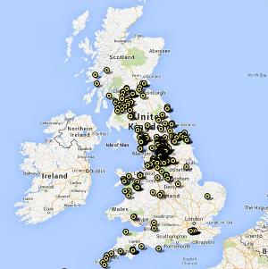
Quarries of the British Isles
The database behind this mapping began life as a paper index of sites in the Northern Cavern & Mine Research Society Records in the early 1960s. It was digitised, in dBASE III format, in the late 1980s and is now held in Access and contains a wide range of information. The Northern Mine Research Society is pleased to make this valuable tool freely available to anyone interested in mining history.
Please note that sites are recorded as point data, but it must be remembered that some occupied larger areas.
Mike Gill - NMRS Recorder
Acknowledgements
No project like this can be completed without help from a wide range of individuals, and over fifty years many people have contributed data, much of it from NMRS publications.
Especial thanks are due to: Matthew Town and Damien Ronan, of Northern Archaeological Associates Ltd, for converting files for use with Google Earth.
This part of the database is, by far, the least well developed and represents an area ignored by many mining historians. Nevertheless, the following is a sample of available works:
Papers
The maps are offered in both 2D format using Google Maps and 3D format; however you must have Google Earth installed on your computer to use this. The Google Earth files are slower to load and run than the 2D maps version, however both contain the same data. Point to and click on a marker to see details of that site.
Please note that sites are recorded as point data, but it must be remembered that some occupied larger areas.
Mike Gill - NMRS Recorder
Acknowledgements
No project like this can be completed without help from a wide range of individuals, and over fifty years many people have contributed data, much of it from NMRS publications.
Especial thanks are due to: Matthew Town and Damien Ronan, of Northern Archaeological Associates Ltd, for converting files for use with Google Earth.
This part of the database is, by far, the least well developed and represents an area ignored by many mining historians. Nevertheless, the following is a sample of available works:
Papers
- Blacker, J.G. 1995 "The Stone Industry of Nidderdale - Part 1, Pateley Bridge" British Mining No.55, pp.47-80
- Blacker, J.G. 1996 "The Stone Industry of Nidderdale - Part 2, Stone Uses" British Mining No.57, pp.5-33
- Johnson, D.S. 2006 "Foredale Quarry, Helwith Bridge, a historical and archæological survey" British Mining No.80, pp.111-134
- Johnson, D.S. 2008 "Excavations of a seventeenth-century lime kiln at Kilnsey, North Yorkshire", British Mining No.86, pp.31-46
- Keating, J. 1982 "Merstham Firestone Mines", British Mining No.19, pp.58-90
- Johnson, D. 2002 Limestone Industries of the Yorkshire Dales (Stroud: Tempus)
- Stanier, P. 1995 Quarries of England and Wales: A Historic Photographic Record (Twelveheads Press)
- Stanier, P. 2000 Stone Quarry Landscapes: The Archaeology of Quarrying in England (Stroud: Tempus)
- Stanier, P. 2009 Quarries and Quarrying (Osprey Publishing)
The maps are offered in both 2D format using Google Maps and 3D format; however you must have Google Earth installed on your computer to use this. The Google Earth files are slower to load and run than the 2D maps version, however both contain the same data. Point to and click on a marker to see details of that site.
Google Maps version |
Google Earth version (slower) |
 |
 |